

Mystery of a Forbidden Place
Mystery of a Forbidden Place
A Secluded Spring and a Bird from the Cahuilla Creation

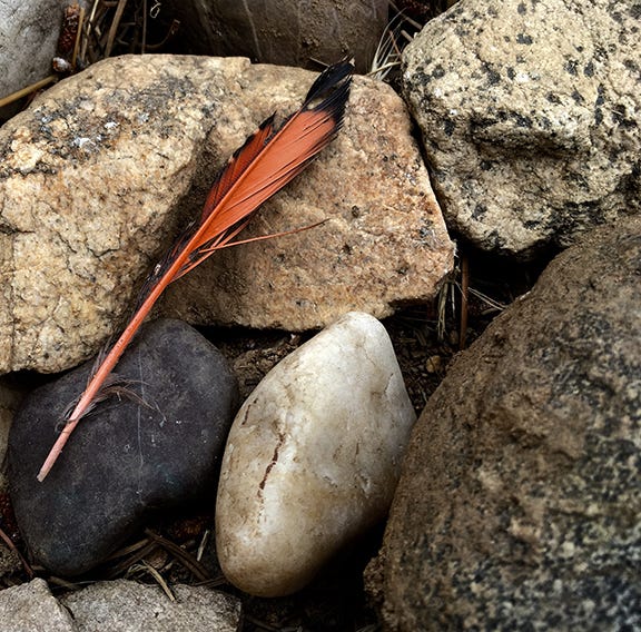
Red-shafted flicker tail feather (Pat Murkland Photo)
By Pat Murkland
Out in the Colorado Desert, geologists say that the red rock hills on the north slope of the Chocolate Mountains came from volcanoes spewing lava in massive flows at least 21 million years ago. Earthquakes also rearranged different layers of rocks and hills there over long spans of time.
This place may seem forsaken and in the middle of nowhere, amid all manners of desert sand, sharp rocks, and boulders, pressed by searing summer heat. Yet it’s a special place of Native American homelands. It’s a place filled with history, starting from the time of Creation.
We’re going to share a little today, a try at making this cultural history a little more accessible, because these Cahuilla lands aren’t a place you can visit. This special place is inside the Chocolate Mountains Aerial Gunnery Range, where the U.S. military conducts live bombing practice in restricted air space and on lands closed to the public. (The signs do warn you it’s dangerous; please keep out. )
You can grab a glimmer of the terrain via Google maps, though.
A Natural Water Tank
This is a place of water. Precious water. Water in the desert, called Tabaseca Tank, also Tabaseco, anglicized from its Cahuilla name. (No, Google, I don’t want to “search instead for tabasco.”)
John S. Brown, who explored the area for the U.S. Geological Survey in the winter of 1917-18,1 described “Tabaseca” as a water basin lying at the base of “two very sharp prominent peaks of red rhyolite” among the volcanic hills. Rocks often are places of power for the Cahuilla people.
‘Rather Remarkable’
“A rather remarkable condition appears to account for the formation of the tank,” Brown wrote. “The arroyo is 10 to 20 feet deep and rather narrow and trenches a fairly smooth surface of red volcanic rock, through which it drains northward. Transverse to this arroyo and dipping about 30 [degrees] S. there is a small slip, probably a thrust fault, the trace of which is well exposed in sides of the arroyo at the tank and consists of a seam of white gouge about 1 foot thick. Along this fault the rock mass to the south has been shoved forward, and the overhanging cliff so formed has been worn back a few feet by a waterfall, which has excavated the pool below now occupied by the tank. This pool is several feet deep, is about 20 feet in diameter, and is full of gravel and rocks. The gravel is generally saturated with water, which can be obtained by digging a foot or two. The water is preserved for a long time, as the cliff of the waterfall shades it, and the gravel prevents animals from drawing heavily upon it.”
Pá
This water basin was crucial in older times to animals and people.
“… Paachim pa'. Pihaqa'tim pa'.
They would drink water. They would drink water from springs,” Dorothy Ramon remembered in Serrano.2
“Wanu'tu'ow qaym 'amay pa' kwana'.
They would not drink water that was flowing in a stream.
“… 'Amaym qay' pa' 'amay wanu'tu'ow. They didn’t drink from rivers.
'Amatunganim piipchim qac pihaqa' peyika'. 'Amaym pa' Taaqtam.
For this reason they would live near springs. That’s what the Indians would drink.”
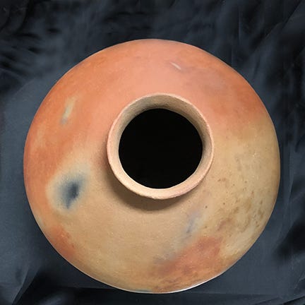
Lightweight Cahuilla clay olla by the late David Largo in a traditional style, for holding water. (From the Siva Family Collection and on display at Dorothy Ramon Learning Center)
This water source was used by people of the First Nations traveling in the desert between what is now California and Arizona. Later, in the 1860s, after learning about this and other water sources from Native Americans, Tabaseca Tank became an essential stop along the stagecoach route from Los Angeles to Arizona. William Bradshaw, the namesake for the stagecoach trail still on USGS maps near the tank, called it, “Tabisaca, point of Mountains,” when he reported about the route in 1862 in the Los Angeles Star newspaper.
The name, which has been spelled variously over the years, comes from the Cahuilla language, trail authority Francis J. Johnston reported in 19773: “Tabaseca has been rendered various ways by various people: Charles B. Genung (Arizona pioneer and sometime Indian agent of the Colorado River Reservation) [who camped there] spelled and translated thus in 1863: Tabbe Sakhe, yellow hammer nests.”
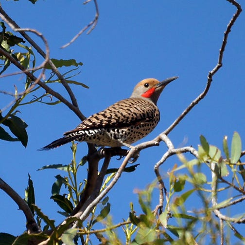
Close, but, we believe, no. “Yellow-hammer” is a nickname from the U.S. South for a Northern flicker (Colaptes auratus), also called the yellow-shafted flicker, an Eastern bird from the woodpecker family. A Northern Flicker that’s a red-shafted flicker is more likely the bird you’ll see in our region and throughout the West.
According to the Cornell Lab of Ornithology, “When they fly you’ll see a flash of color in the wings — yellow if you’re in the East, red if you’re in the West — and a bright white flash on the rump.”

Northern flicker (red-shafted). (Photo by Dominic Sherony, courtesy of Wikimedia Commons)
.jpg)
Cahuilla leader Francisco Patencio said in his 1943 cultural memoir that the name of the natural water tank in the Chocolate Mountains is Ta vish heck ke4, “home of the wood-pecker bird.” (Flickers are woodpeckers.)
The late Cahuilla Elder Katherine Siva Saubel told Frank Johnston in 1966 that the name is “Tavis Heki, Home of the Red-Shafted Flicker.” 5
A Bird of Power
Northern Flicker (red-shafted) in the UC Riverside Botanic Garden in Riverside.
(Photo by Mike’s Birds, courtesy of Wikimedia Commons)
At first glance the red-shafted Flicker seems unassuming. It is one woodpecker that doesn’t drill holes into trees to store food. Instead, Flicker walks around on the ground, using a big, curved bill to dig for ants, beetles, and other food. Cahuilla people in Palm Springs told zoologist C. Hart Merriam in 1907 that Flicker is called Tah’-vish.6
Anthropologist Lowell John Bean recorded it as Távish 7, adding, “a being of great power and authority.”

Adult female tail feathers, courtesy of the U.S. Fish and Wildlife Service Feather Atlas of North American Birds.
Red-shafted flicker feathers were used by a traditional puul, or medicine man, to cure illness, according to Lowell Bean. The feathers also were used in the Big House, or Ceremonial House, hanging together as sacred ropes during rituals or sacred occasions, such as during mourning ceremonies. In Palm Springs, the sacred bundle containing objects used in ceremony often held narrow bands of flicker feathers, according to anthropologist William Duncan Strong. 8
Why? Flicker has a very loud, piercing call that it repeats often. This, according to the Cahuilla Creation story, came from Flicker’s important role: After Creator Mukat began playing evil tricks that caused people to die, and mistreated the Moon Maiden, the people debated what to do.
“Now these people, no cot em, that were left behind became dissatisfied, so they were having a talk with each another, what they should do with this Mo-Cot,” Francisco Patencio said.9
“Ta va wit, the great woodpecker, said, ‘Pe om,’ which meant for the witch doctors to witch Mo-cot. Until then, the woodpecker was not saying this word, but ever since he can be heard saying ‘Pe-om-pe-om.’”
Listen to this loud-mouthed flicker call recorded in Marin, California, by Thomas G. Sander, Macauley Library:
“Kíll míyaxwe písh pe' méxanpi'. They could not do anything to him [Creator Múkat],” the late Elder Katherine Siva Saubel said in her 2004 Cahuilla cultural memoir.10
“Pé'pá' metéewqa'pé'. And then he (Múkat) was watching them.
“Pé' ish pé' e' tá' wíkikmal yáqa'. And so that bird told them. … ‘Chéqe' píam,’ yáqa.' ‘Just bewitch him,’ he (the flicker) said.”
Thank you!
Thanks for reading News from Dorothy Ramon Learning Center! We welcome your EMAIL. Thank you from Editor Pat Murkland, July 27, 2022.
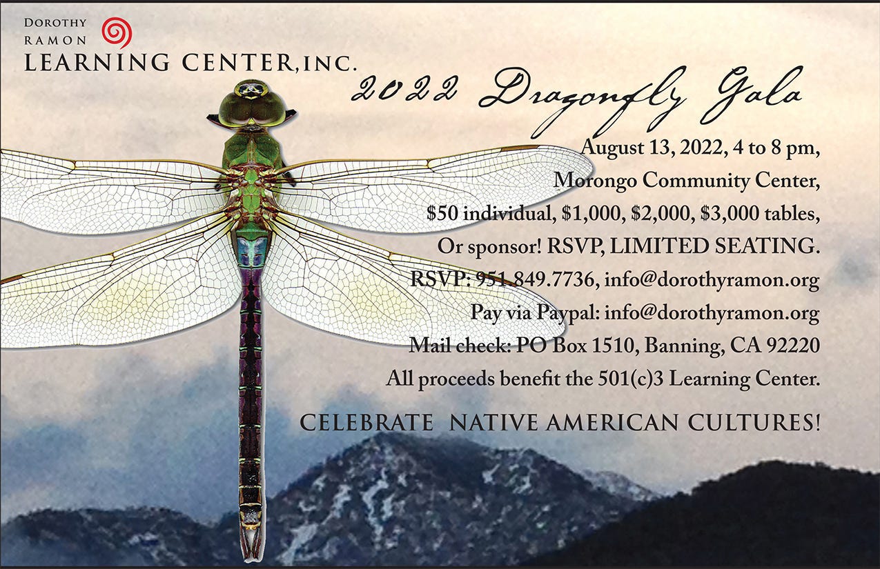
You’re invited to come support the 501(c)3 nonprofit Learning Center and celebrate Southern California’s own Native American cultures, languages, history, and traditional arts at the August 13, 2022, Dragonfly Gala at Morongo Reservation. Along with enjoying traditional bird songs from the Morongo Bird Singers and Dancers and the Madrigal Bird Singers and Dancers, come eat a delicious BBQ dinner, enjoy Native American cultural displays, bid in our epic silent auction, and applaud artist Gerald Clarke, this year’s Dragonfly Award winner for soaring achievements in saving and sharing Native American cultures. Seating is limited!
John S. Brown, “The Salton Sea Region, California.” 1923, U.S. Geological Survey Water-Supply Paper no. 497, Government Printing Office, Washington, D.C., pp. 248-249, as cited by Jane Davies Gunther, in Riverside County, California, Place Names: Their Origins and Stories, © 1984 by Jane Davies Gunther, p. 520.
Dorothy Ramon and Eric Elliott, Wayta' Yawa': Always Believe, Malki Museum Press, 2001, “Drinking Water,” p 101.
Francis J. Johnston, The Bradshaw Trail, revised edition, © 1987 by Francis J. Johnston, Historical Commission Press, Riverside, California, p. 204.
Francisco Patencio, as told to Margaret Boynton, Stories And Legends of the Palm Springs Indians, 1943, Palm Springs Desert Museum, p 62.
Francis J. Johnston, The Bradshaw Trail, p. 204.
From, C. Hart Merriam, Indian Names for Plants and Animals among California and other Western North America Tribes, assembled and annotated by Robert F. Heizer, © 1979 by Ballena Press, New Mexico.
Lowell J. Bean, Sylvia Brakke Vane, Sue Myers, and James Toenjes, “Cahuilla Ethnozoology: Database and Report on Sixteen Faunal Species found in the Cahuilla Territory,” prepared by Cultural Systems Research, Inc., January 2007, for United States Department of the Interior Bureau of Land Management, Palm Springs, California, pp. 22-23.
William Duncan Strong, Aboriginal Society in Southern California, 1972 reprint by Malki Museum Press, p. 61. Reprinted from University of California Publications in American Archaeology and Ethnology, Vol. 26, 1929, by permission of the Regents of the University of California.
Francisco Patencio, Stories And Legends of the Palm Springs Indians, pp 14-15.
Katherine Siva Saubel and Eric Elliott, ‘Isill Héqwas Wáxish: A Dried Coyote’s Tail, Vol. 2, 2004, Malki Museum Press, “Flicker Bird Ordering the Death of Múkat,” reading 776, pp. 1129-33.